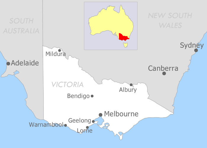
Victoria Map
Despite it's comparatively small size, you'd be forgiven for assuming that Victoria was one of the larger players for all it's got going on. In this Victoria map, you'll find Melbourne at the centre of Port Phillip Bay. On the waters edge you'll come across iconic suburbs like the Docklands, Port Melbourne, St Kilda and Brighton (with the famed bathing boxes).
At the mouth of the bay, visitors will find the seaside villages of Queenscliff and Sorrento. Connected by a regular ferry service, this is a great idea for a day excursion and a good way to cover a lot of ground on your Victorian holiday. From Queenscliff, hire a car (or bring one with you across the bay) and drive to the little surf town of Torquay. This is where you'll start the renowned Great Ocean Road drive, winding your way along awe-inspiring cliffside road, through the coastal towns of Anglesea, Aireys Inlet, Lorne and Apollo Bay. Stop at the striking 12 Apostles and make your way back to Melbourne via the stunning Beech Forest.

During your time in Victoria, it's well worth visiting the Gold Rush town of Ballarat. This pretty, heritage city has a rich history and is situated just minutes from the engaging Sovereign Hill. Take a day trip into the Yarra Valley wine region, experiencing some of the states best food and wine. Remember to stop in at Healesville Sanctuary where many of Australia's native wildlife can be found (and in some cases, held).
Finally, no Victorian holiday is complete without a visit to the windswept and rugged Phillip Island. While most visitors come for the wildlife, they stay for the deserted surf beaches and quaint village life. Be sure to visit the fairy penguins as they make their nightly pilgrimage up the beach and into their nests.

